
Things to do in Chhukha/Phuentsholing
Chhukha is the district you enter Bhutan through if you come by road, and Phuentsholing is the border town at the bottom of it — hot, busy, pressed against the Indian town of Jaigaon, and completely unlike the valleys above. Most guests see it on a first or last day.
It is also the second most populous district in the country, and where two of Bhutan's biggest power stations stand.
Things to do in Chhukha, compared
| Attraction | Time needed | Legwork | Best season |
|---|---|---|---|
| Phuentsholing town & Jaigaon | 1–2 hrs | Level town walking on the flat border strip, and it is hot | Oct–Mar; ask us about crossing to Jaigaon |
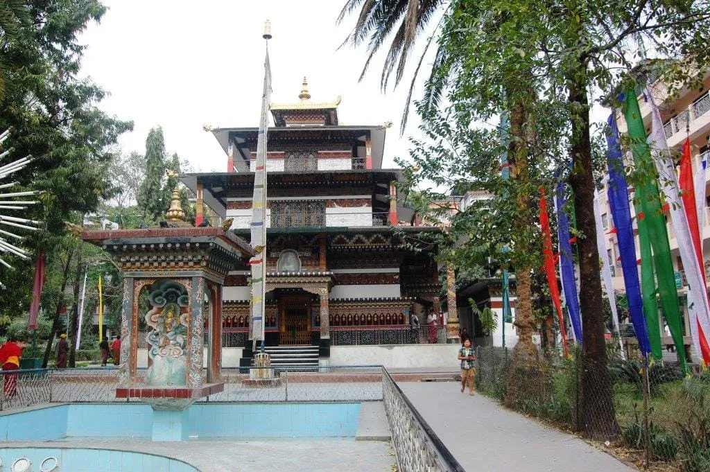
| Zangto Pelri | 20–30 mins | Level, in the middle of town about 250 m from the centre | Year-round; late afternoon, when people gather |
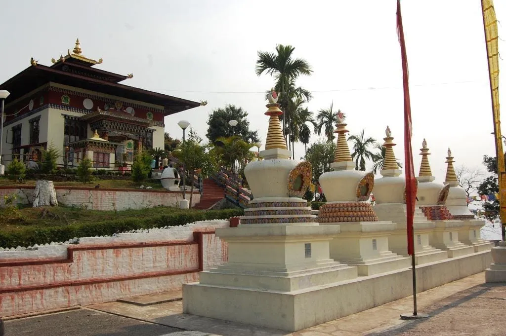
| Kharbandi Goenpa | 30–45 mins | 20 mins up the switchbacks, then a garden terrace at 400 m | Year-round; cooler than the town |
| Milarepa Lhakhang | 30–45 mins, plus ~40 mins' drive each way | Not in the town — 16 km up the Thimphu highway. Road access; whether you go inside or up is ask us | Year-round, on the drive north |
Entrance fees are included in every tour we run, so there's no ticket window to queue at and no cash to carry. One of these is free to everyone in any case: the Department of Tourism's monument circular of 15 March 2023 names Rinchending Lhakhang — Kharbandi — among the sites that charge nothing at all. It is the only place in this district that circular mentions either way.
What actually fits in a day?
The town, its temple and the monastery above it are a genuine half-day — three to four hours including the climb up to Kharbandi and back, which is the right shape for an arrival morning or a departure afternoon.
Milarepa Lhakhang is not part of that. It stands 16 kilometres up the Thimphu highway, so you collect it on the drive north rather than doubling back — add the column up with the driving included and all four come to between four and a half and six hours, which is a day and not a half of one.
The border, and the arrival
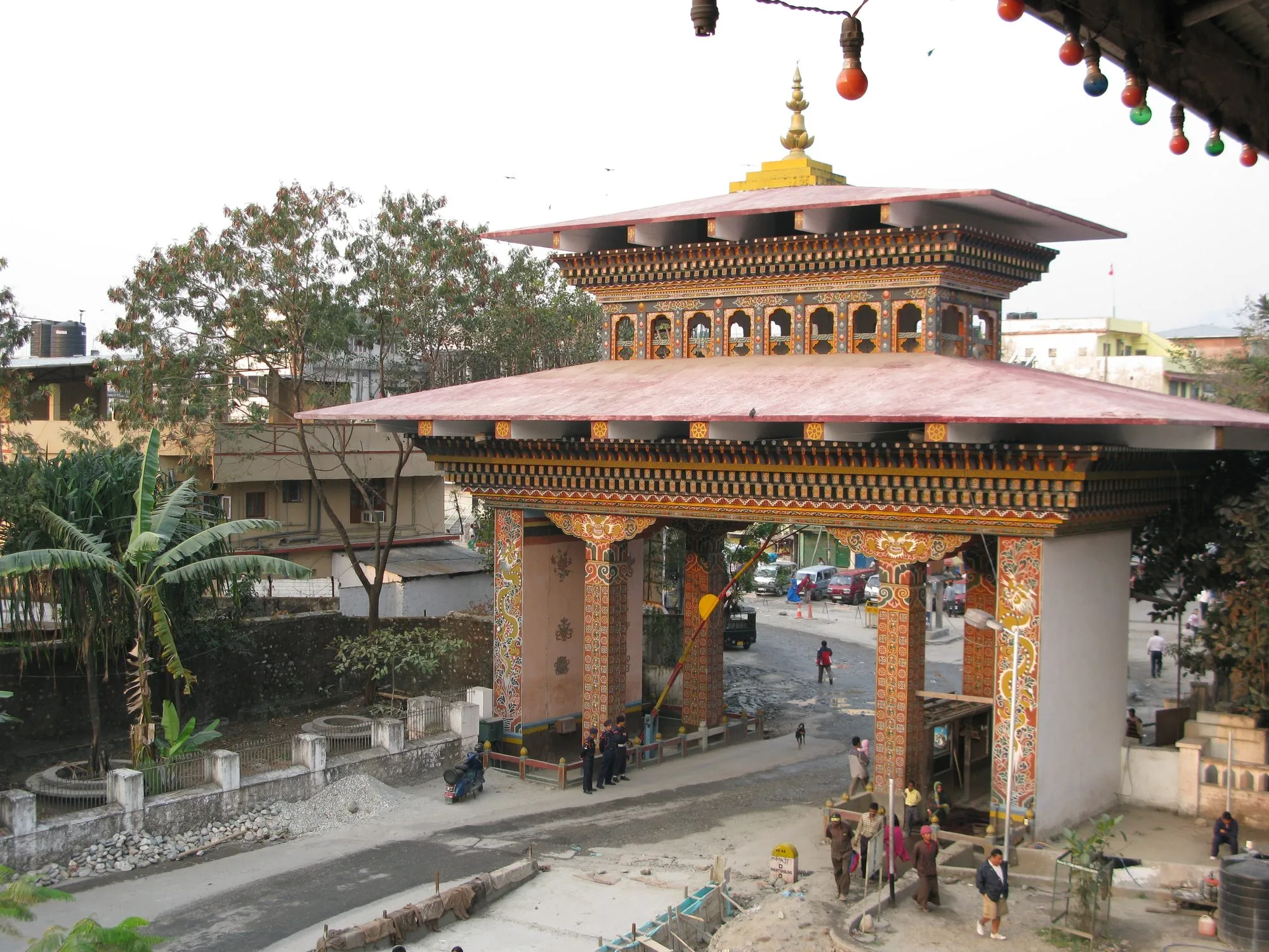
Phuentsholing and Jaigaon are one continuous built-up area with a national frontier down the middle of it — a long wall with a single Bhutanese gate. The immigration checkpoint here is where visa-holding visitors get their stamp — Indian nationals travel on a permit instead, applied for online or at this port of entry — and your guide meets you at that gate either way.
Whether you can walk across into Jaigaon is a question for your guide, not for a web page. The border was free-flowing for years and measures tightened after 2020; what applies on the day you are there is something we check rather than publish.
Bagdogra airport is four to five hours away in West Bengal, which is what makes this the classic route for combining Bhutan with Darjeeling or Sikkim.
The drive north, and the dams
165 kilometres and about five to five and a half hours to Thimphu — a full day's drive, from around 300 m on the plain to a capital that sits between about 2,250 m and 2,650 m. It is the most abrupt change of scene in Bhutan. Phuentsholing is also where Bhutan's main highway starts: the Lateral Road runs from here some 636 kilometres east to Trashigang.
On the way you pass the Chhukha and Tala hydropower projects, both on the Wang Chhu — Tala sits downstream of Chhukha on the same river. Chhukha produces 336 MW and was commissioned in 1986–88; Tala produces 1,020 MW through six 170 MW turbines and was commissioned across 2006–07. That is 1,356 MW between them. We don't take guests into either — they are landmarks on the drive rather than stops — but they are worth knowing about: Chhukha was Bhutan's first mega power project, funded by the Government of India at 60% grant and 40% loan.
The rest of the district
Most of Chhukha is neither the border nor the dams. It covers 1,880 km² across eleven gewogs — Bjagchhog, Bongo, Chapcha, Darla, Dungna, Geling, Getana, Logchina, Metakha, Phuentsholing and Sampheling — with 68,966 people at the 2017 census, which makes it the second most populous district in Bhutan after Thimphu. The dzongkhag town is Tsimasham, up at around 2,200 m; Gedu, the college town, sits on the highway at about 1,960 m.
When to come
October to March. Phuentsholing sits on the plain with a sultry tropical monsoon climate — close to four metres of rain a year, and a record high of 40 °C set on 27 August 1997. From April through the monsoon it is genuinely hot and wet, a different climate from anywhere else you will go on the same trip. Bring the layers for the valleys, not for here.
Attractions in Chhukha/Phuentsholing
Tailor-made travel
Begin your journey to the Last Shangri-La
Every Little Bhutan itinerary is private and tailor-made. Tell us what draws you to Bhutan — festivals, treks, monasteries, food — and we will design the journey around it.