Phuentsholing Town/Jaigaon

Phuentsholing is where most people who come to Bhutan by road first stand in it. It is the second-largest city in the country and its commercial capital, on the plain at 293 metres, pressed against the Indian town of Jaigaon — and it is completely unlike everywhere you are about to go.
One to two hours covers the town. Most guests see it on a first or last day.
What is actually there?
A border, a temple, and a wall. The boundary between the two towns is a long wall with a single Bhutanese gate — that gate is the thing to look at, because a national frontier running down the middle of one continuous built-up area is not a common sight.
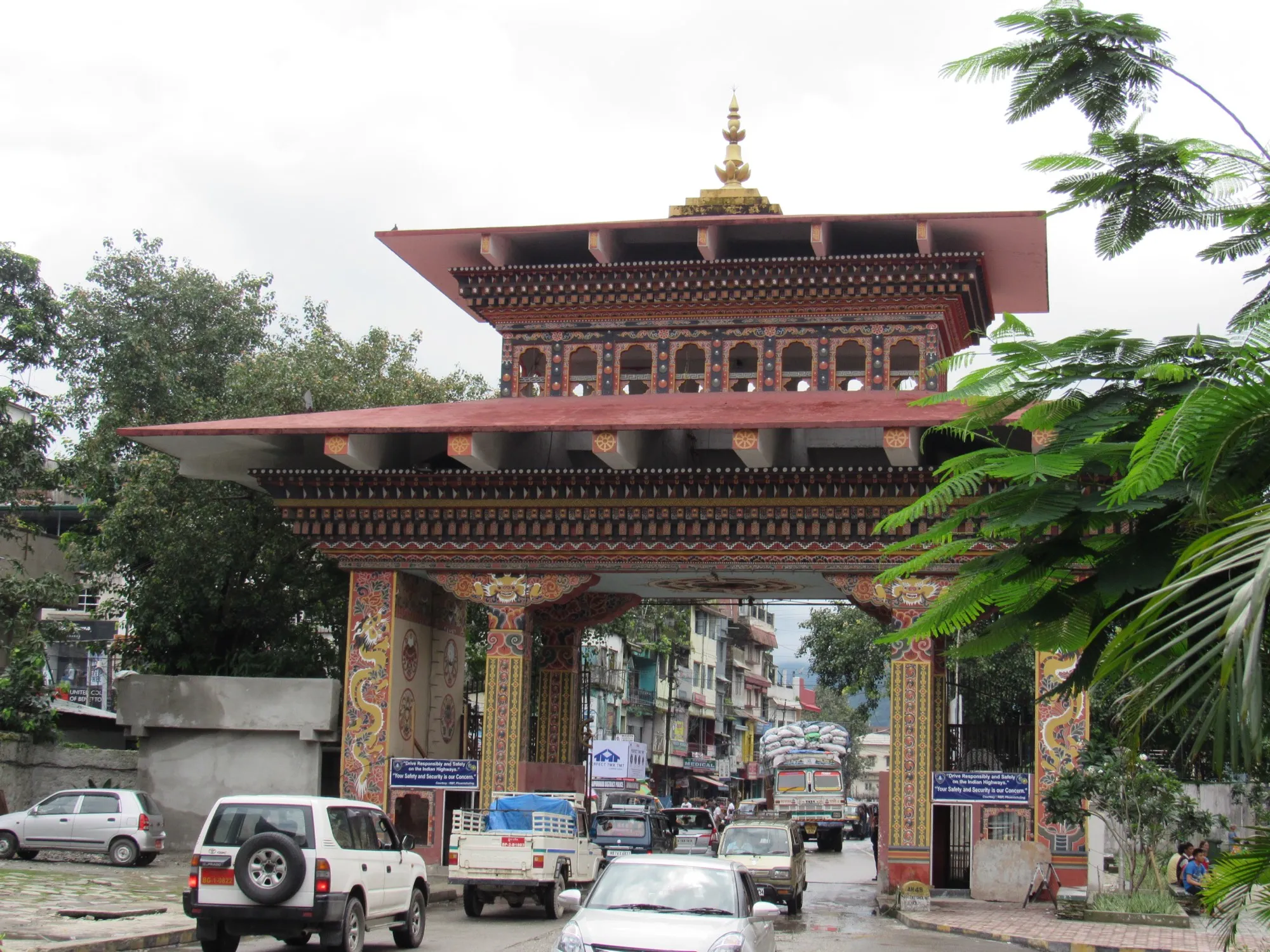
The gate, from the Jaigaon side — Indian street on this side, Bhutan on the other. Photo: Afifa Afrin, CC BY-SA 3.0.
In the centre is Zangto Pelri, a temple representing Guru Rinpoche’s paradise, with a garden around it where the town gathers late in the day. Up the hill, Kharbandi Goenpa looks back down over all of it from 400 m.
The buildings themselves are the other thing to notice. Southern Bhutanese building is flat-roofed and concrete where the valleys are pitched, shingled and timbered — so your first hour in the country looks nothing like the pictures that brought you, and your second day looks exactly like them. That is our own observation rather than anyone’s published finding, but it is the one guests remark on most.
Can you cross into Jaigaon?
Ask us.
The border was free-flowing for years and measures tightened after 2020. Whether an international visitor can walk across on the day you are there is a question for your guide, who will know that week’s position — and it is not something we will publish a rule about, because a rule that is a year out of date is worse than no rule.
How does the arrival work?
The formalities happen here. For visa-holding visitors entering overland from India, the immigration checkpoint in Phuentsholing is where the visa goes into the passport; Indian nationals travel on a permit rather than a visa, applied for online or at the port of entry, which is this one. Either way your guide meets you at the border gate. See travel requirements for what you need in hand.
Bagdogra airport is four to five hours away in West Bengal, which is what makes this the classic route for anyone combining Bhutan with Darjeeling or Sikkim. Whether you can come back this way afterwards depends on your Indian visa rather than your Bhutanese one — see entering Bhutan by road.
What is the drive north like?
165 kilometres and about five to five and a half hours to Thimphu — a full day.
You start at around 300 m and finish in a capital that sits between about 2,250 m and 2,650 m, and it is the most abrupt change of scene in the country: plains and heat at breakfast, pine forest and cold air by evening. This is also where Bhutan’s main highway begins — the Lateral Road runs from here some 636 kilometres east to Trashigang, which is the same road our Mongar and Trashigang pages are strung along at the far end.
When should you come?
October to March.
Phuentsholing has a sultry tropical monsoon climate with close to four metres of rain a year, and the highest temperature on record here is 40 °C, on 27 August 1997. From April through the monsoon it is genuinely hot and wet — a different climate from anywhere else on your itinerary. Pack for the valleys, not for here.
See things to do in Chhukha for the rest of the district.
Frequently asked questions
Can I walk across the border into Jaigaon?
Ask us — and that is a real answer, not a dodge. The border was free-flowing for years and measures tightened after 2020. What applies to an international visitor on the day you are there is a question for your guide, who will know that week's position; it is not something we will publish a rule about and risk being a year out of date.
How long do you need in Phuentsholing?
One to two hours for the town itself, which usually means the temple and a walk. Most guests see it on a first or last day rather than as a destination — it is the arrival, and then you climb.
What is the drive from Phuentsholing to Thimphu like?
165 km and about five to five and a half hours — a full day, not a morning. You start on the plain at around 300 m and finish in Thimphu, which sits between about 2,250 m and 2,650 m, and the road climbs and winds the whole way. See getting to Bhutan for the rest of the distances.
When is the worst time to be in Phuentsholing?
April through the monsoon. This is a sultry tropical climate on the plain, with close to four metres of rain a year and a record high of 40 °C, recorded on 27 August 1997 — a completely different climate from the valleys you are heading to on the same trip. October to March is the window.
Tailor-made travel
Begin your journey to the Last Shangri-La
Every Little Bhutan itinerary is private and tailor-made. Tell us what draws you to Bhutan — festivals, treks, monasteries, food — and we will design the journey around it.