
Things to do in Mongar
Mongar is the hinge of eastern Bhutan: the district you cross to get anywhere else out here, and the one with the hospital everybody else depends on. Most people give it an afternoon and a night on the way to Trashigang — and the two best things in it, the pass and the ruined fortress, are both on the road you are already driving.
Things to do in Mongar, compared
| Attraction | Time needed | Legwork | Best season |
|---|---|---|---|
| Thrumshing La Pass | 20–30 mins at the pass | Roadside — you step out of the vehicle at 3,780 m into whatever the weather is doing. What stands at the pass is not published — ask us | Oct–Feb for clarity; snow can close it — ask us |
| Ruins of Zhongar Dzong | 1.5–2 hrs | ~10.5 km west of town in a straight line, roughly 20 km by road — no drive time is published, ask us — then half an hour uphill on a footpath, to an unmanaged ruin — nobody publishes how much is standing, ask us | Mar–May, Sep–Nov |
| Mongar Dzong | 45 mins–1 hr | Road access to the door, then steps and several levels inside | Nov or Dec for the three-day tshechu — the dates move; year-round otherwise |
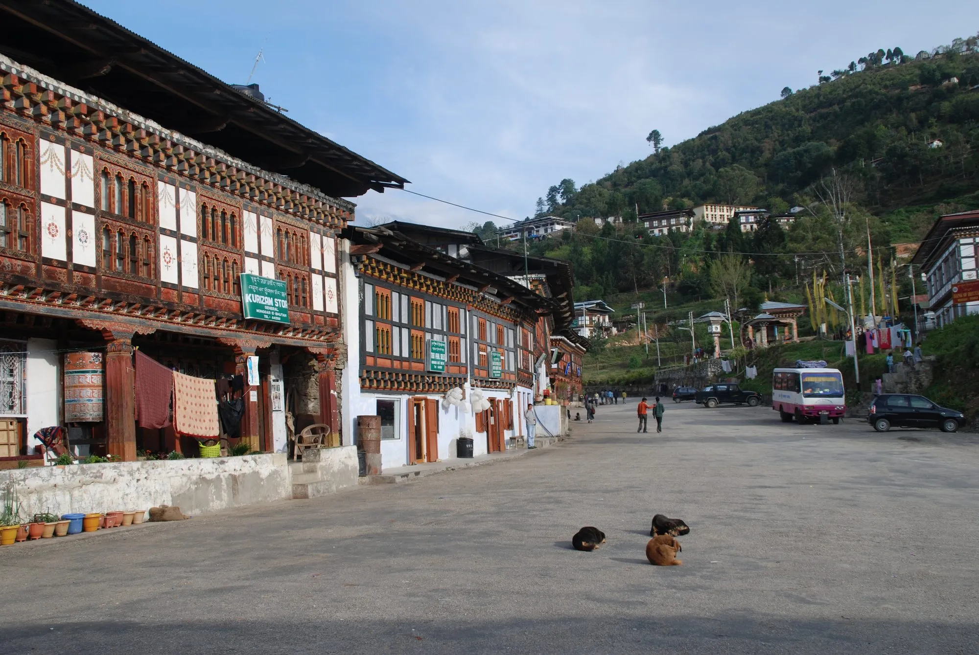
| Mongar Town | 30–45 mins | Built up a hillside — everything is above or below something else | Year-round |
| Aja Ney | Two days at the very least — about six hours' walk each way. Ask us | ~6 hrs on foot from the 2023 road head at Yarab, 13 km out, with iron ladders fixed between the sites; the ney runs from 2,400 m to 3,500 m | Oct–Mar only (window last published 2019) — closed the rest of the year under Ladam |
Entrance fees are included in every tour we run, so there's no ticket window to queue at and no cash to carry at any of them.
This does not fit into one day, and nothing here pretends it does. Thrumshing La is crossed on the drive in from Bumthang rather than visited from Mongar. The dzong and the town are a comfortable morning. Zhongar is a half-day of its own, and Aja Ney is a separate trip in a season of its own.
The pass, and how high it really is
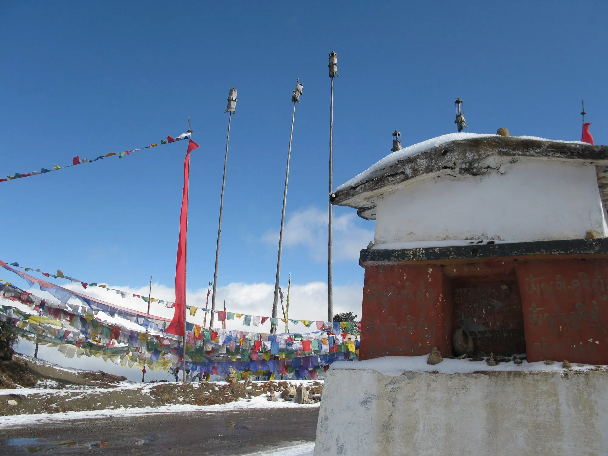
Thrumshing La divides Mongar from Bumthang at 3,780 m and is the highest point on Bhutan's east–west highway — but not, as a great deal of published copy says, the highest pass in the country. Chele La is higher, at 3,988 m. Ours was among the copy that had it wrong, and it is fixed.
What makes this pass worth the stop is not the top but what follows: the road falls about 3,100 m from here to Lingmethang, through fir, then broadleaf, then wet subtropical forest, which is why the Bumthang–Mongar drive takes six and a half to seven hours for 183 kilometres.
Snow closes it some winters, and when it does there is no other road east. If you are crossing between December and February, ask us.
The road below the pass is one of Asia's great birding runs
Because that descent crosses so many forest types in a single run, the stretch through Sengor and Yongkola is a serious birding destination in its own right. Our own birding itinerary camps on it for three nights and calls the Yongkola broadleaf forest the birding capital of the world.
At the top it is Blood Pheasant, Spotted Nutcracker and Snow Pigeon; lower down, Rufous-necked Hornbill, Blue-naped Pitta, Collared Treepie and babblers by the dozen. If birds are why you are coming to Bhutan, this district is the reason.
Two dzongs — one working, one that stopped
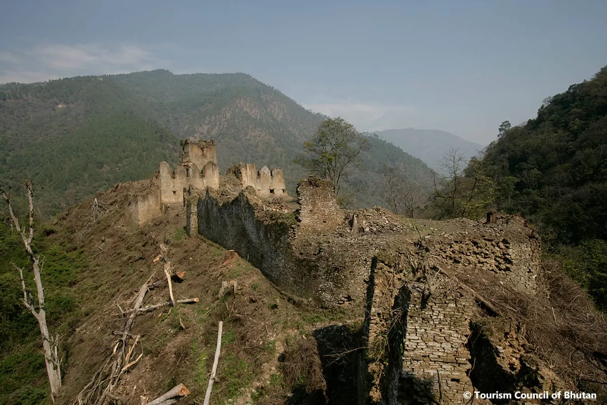
Zhongar Dzong is the fortress this district was named after before it was called Mongar: built in the seventeenth century of white stone from the Kuri Chhu — zhong kar, the white bowl — over about four acres, and ruined by fire and then an earthquake. Nobody agrees on when, so the page does not date it. What it does tell you is the story people here tell: the architect had his hand cut off at the feast celebrating the finished fortress, so that he could never build a finer one, and its destruction is held locally to be his curse coming back on it.
Half an hour's walk up from the road, with nobody else there. That is a rarer thing in Bhutan than a working dzong.
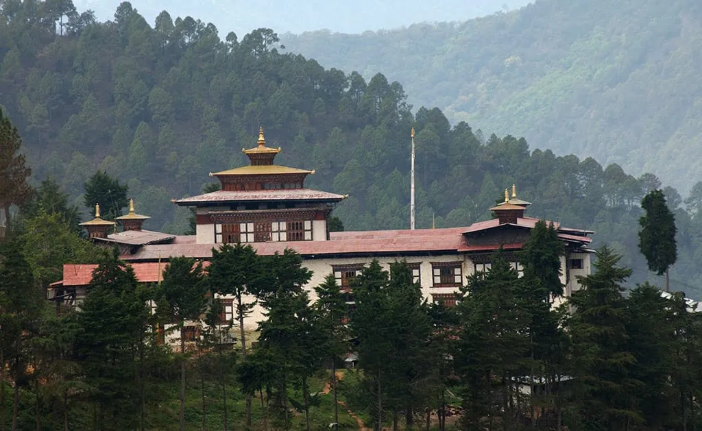
Mongar Dzong is what replaced it, up in the town. It has two entrances where almost every dzong has one, and the monastic body and the district administration share a single courtyard rather than being walled apart as they are in Paro or Punakha. It was built by the old method — no nails, no drawings — in the twentieth century, and the date is genuinely disputed: 1930 and 1953 both circulate. The version to ignore is the one crediting 1930 to the Third King, who was a year old at the time.
The Mongar Tshechu fills its courtyard for three days every November or December — 17–19 Nov 2026, 6–8 Dec 2027 — and the thongdrel goes up at four in the morning on the last day. The crowd is local — the district and the districts next door — where Paro's is far bigger and shared with the rest of the world.
For pilgrims
Aja Ney is a cave carrying a hundred imprints of the syllable Aa, left by Guru Rinpoche, with a spring beside it held to cure eighteen ailments. It is one of the three neys — with Omba Ney in Trashi Yangtse and Hungrel in Paro — that together spell Om Ah Hung, and Bhutanese cross the country to walk all three.
It is about six hours on foot from the road head at Yarab — that was where the farm road ended as of 2023, and it has been advancing — and open only from about October to March, on the window last published in 2019. From roughly April to September the mountain is closed under Ladam, and an itinerary outside that window cannot include it. It is not a sightseeing walk and it should not be sold as one — ask us if you want to do it properly.
Where it is, and what it is like
Mongar sits on the east–west highway between Bumthang (183 km, about 6.5 to 7 hours, over Thrumshing La) and Trashigang (79 km, about 2.5 to 3 hours, over Kori La), with Lhuentse 3 to 3.5 hours north. It borders Lhuentse to the north, Trashi Yangtse to the north-east, Trashigang to the east, Pemagatshel to the south, Zhemgang to the south-west and Bumthang to the north-west.
The dzongkhag covers about 1,940 km² across 17 gewogs, running from 400 m to 4,000 m — subtropical at the bottom, temperate at the top — and the 2017 census counted 37,150 people — against a 2022 projection of 36,383, which is the direction of travel. On that projection roughly ten thousand of them live in the district's six small towns and twenty-six thousand do not. The rivers are the Kuri Chhu, the Sheri Chhu and the Drangme Chhu.
Two things are worth knowing about the people here. The Eastern Regional Referral Hospital is in Mongar and serves the six eastern dzongkhags and Bumthang — it is why this district matters far beyond its size. And Mongar keeps languages that survive nowhere else: alongside Tshangla, the district's centre speaks Chali and its south speaks Gongduk, the sole surviving representative of its own branch of the Tibeto-Burman family.
The district is known for lemongrass, distilled here for essential oil, for tengma — beaten maize, from Chhaling and Saling — and for the Kurichhu hydropower plant at Gyalpozhing. Much of northern Mongar lies inside Phrumsengla National Park, named after the pass, and its north-eastern corner inside Bumdeling Wildlife Sanctuary, where Aja Ney is.
Attractions in Mongar
Tailor-made travel
Begin your journey to the Last Shangri-La
Every Little Bhutan itinerary is private and tailor-made. Tell us what draws you to Bhutan — festivals, treks, monasteries, food — and we will design the journey around it.