Community based Ecotourism – Gomphu-Manas-Norbugang Eco-trail
 An unparalleled biological treasure in the Eastern Himalayas, Royal Manas National Park (RMNP) represents the largest example of tropical and sub-tropical ecosystems in Bhutan. With hundreds of wildlife, birds and plant species, several globally endangered, Royal Manas is not only the most diverse protected area in the Kingdom but also one of the world’s biologically outstanding conservation sites. The park is the fourth largest national park in Bhutan with an area of 1057 km2 and covers the three districts of Sarpang, Zhemgang and Pemagatsel. The park area begins from the plains of Manas River in Bhramaputra basin at 108 meters and extends up to 2600 meters above sea level.
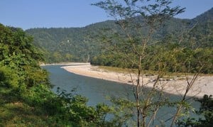
After being maintained as a forest reserve by the Royal Government of Bhutan for many years, Royal Manas was notified as a wildlife sanctuary in 1964, making this park, the nation’s oldest protected area. In 1993 the area was upgraded to a national park. Now, it forms part of the Bhutan Biological Conservation Complex, an extensive system of protected areas and biological corridors covering over 50 percent of the country.
Royal Manas is linked to Jigme Singye Wangchuck National Park to the north and India’s Manas Tiger Reserve in the south. The park is also linked to Phibsoo Wildlife Sanctuary and Thrumshingla National Park through biological corridors, Figure 1. The principal reason for this linkage is to provide a continuous gradation of protected natural habitats from tropical duars all the way to alpine Himalayan highlands. This initiative is without doubt a unique conservation achievement in the Himalayas. Today this largely unexplored treasure is opened to tourists to promote community based ecotourism in the park.

Flora and Fauna
The park’s location and the largely pristine forest, which covers approximately 92% of the area, make the park extremely rich in biodiversity. There are five different vegetation types which consist of tropical monsoon forest, subtropical broadleaved forest, warm broadleaved forest, cool broadleaved forest and evergreen oak forest.

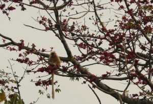
These habitats support a wide range of fauna, including many rare and endangered species such as the Royal Bengal tiger, Asian elephant, gaur, wild buffalo, wild dog, common leopard, black panther, marveled cat, golden cat, clouded leopard and Chinese pangolin. Species endemic to the Eastern Himalayan foothills, such as golden langur, capped langur, pygmy hog and hispid hare also occur in the park.
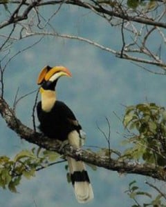
The park is also extremely rich in avifauna and other lower vertebrate and invertebrate fauna. A total of 530 species of birds have been recorded so far, highest among all protected areas. Globally endangered species include the Rufous-necked hornbill and Pallas fish eagle, and 14 other species recorded from the park that are considered to have globally significant breeding populations in Bhutan.
The chestnut-breasted partridge for which there are no recent records outside Bhutan has also been recorded in this richly forested park. In addition, more than 900 species of vascular plants have been recorded in the park. Several of these species have value as cultivars for agriculture crops and other horticultural uses, and a number of others are of immense economic, medicinal, traditional, and religious significance.
Local Communities
The local communities residing in the park are from the five geogs/blocks of Trong, Phangkhar and Nagala geogs under Zhemgang district; Umling geog under Sarpang district and Norbugang geog under Pemagatshel district. There are a total of 1026 households with an approximate population of 10646 people living in and around the park. Agriculture and livestock rearing form the main source of income for these communities. They form some of the poorest communities in the country highly dependent on the forest resources for their livelihoods.
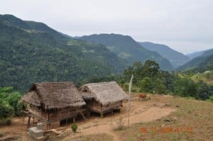
The local population primarily consists of ethnic group known as Khengpas, who practice subsistence slash and burn agriculture farming for cultivating crops such as maize, millet, rice and wheat. Orange and cardamom also are cultivated in some areas. Khengpas live in traditional houses built of stone, mud, and wood as well as one can come across houses made of bamboo roofed with banana leaves. Besides the Khengpas, the other minority ethnic group is the Tshanglas, who are mainly settled in Bjoka and in Kheng Edi. They are believed to have migrated from the east in search of better land. They speak both Tshanglas and Khengkha. The local communities have rich history, culture and traditions with each village celebrating different local festivals, songs and dances. Besides Buddhism, Bonism is also practiced in some places.
Community based ecotourism program in Royal Manas National Park
The community based ecotourism program in Royal Manas National Park was initiated in 2010 with support from WWF Bhutan. The program was initiated in line with the Royal Government’s poverty alleviation theme of the current 10 Five Year Plan (2008-2013) to benefit rural communities from conservation through ecotourism. Accordingly, ecotourism was identified as a priority program for park and the Department of Forests and Park Services, Ministry of Agriculture and Forests.
Moreover community based ecotourism in the park provided opportunity to diversify tourism products in the country and address the issue of seasonality associated with low tourist visitation to Bhutan in the winter season. Since the park is rich in terms of both natural and cultural resources, the park has lot of potentials for ecotourism in the country.
In order to pilot community based ecotourism in the park, Gomphu-Manas-Norbugang eco-trail was selected. This is because the communities living along this trail are one of the least developed communities in Bhutan with high incidence of poverty.
Objectives of the community based ecotourism
- To promote local stewardship and community participation in conservation of species and sub-tropical ecosystems in the park through benefit from ecotourism.
- To provide alternative source of livelihoods for local communities to reduce pressure on the park’s natural resources and help alleviate poverty.
- To offset losses suffered by local communities from crop damage and livestock depredation by wildlife in the park and
- To create awareness on the importance of biodiversity conservation and reduce threats such as poaching and illegal use of natural resources in the park.
Beneficiaries:
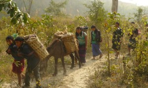
About 150 households living in villages along the Gomphu-Manas-Norbugang eco-trail are beneficiaries of the community based ecotourism program. Agriculture farming and livestock rearing form the main sources of their livelihoods. Due to small land holdings, their income from farming is marginal. The main source of cash income is from sale of oranges and through portering services. Major agriculture crops grown are rice, maize and millet. Majority of the communities speak local dialect known as Kheng kha followed by tshangla.
The services and facilities along the eco-trail are managed by the five community management groups of eco-camps located at Gomphu , Pangtang, Shilingtoe, Pangbang and Norbugang. The benefit sharing mechanism has been worked out as follows:
- 70 % of the revenue goes to individual members providing services
- 25% to the community fund and
- 5% to the Royal Manas National Park
Eco-trail information
Gomphu-Manas-Norbugang eco-trail
Entry/exit points: Gomphu, Zhemgang or Pangbang, Zhemgang via Indian Manas or Nanglam,S/Jongkhar.
Preparing for visit: Like visiting any other national parks in the country, park permit is required which can be collected from the office of Nature Recreation and Ecotourism Division, Department of Forests and Park Services located below Jungshi paper factory, Thimphu during office hours.
Since the entry and exit points along this eco-trail passes through India, double entry visas for both Bhutan and India would be required. The nearest immigration office is located at Gelephu and Samdrupjongkhar.
Best time to visit: Early spring (March-April), autumn (September-October) and winter season (November-February).
Average walking distance: 4 hours daily between eco-camps
Things to experience: Hike through the warm broadleaf forests rich in birds, plants, butterflies and wildlife. Experience local way of life, culture, festivals, performances, sports, arts and crafts, hotstone/hotspring bath at the five community managed eco-camps, which are unique. Hike to local cultural sites and natural features such as bats cave and limestone caves and experience river rafting and elephant rides.
Facilities and Services: Each eco-camp has two eco-lodges with twin beds in each lodge and camping area with kitchen, dining, toilet/bathroom, fencing and drinking water facilities. Facilities at each camp are built on 50 decimal government land using locally available materials such as wood, bamboo, stone, mud and other materials. The community management groups provides services such as meals, local guides, village tours, cultural performances, local sports, hotstone/hotspring bath and many other services.
Recommended Pax size: Maximum of 13 pax at one time in each eco-camp in order for smooth catering of services by community management groups at each eco-camp.
Map of Gomphu-Manas Eco Trail
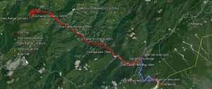
Eco-trail Itinerary
Day 1: Gomphu – Pangtang
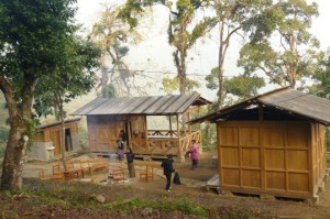 Gomphu is the first eco-camp located at an altitude of 1457 meters above sea level. Gomphu can be reached from either Zhemgang or Gelephu. From Zhemgang, it takes 3 hrs to reach Gomphu and from Gelephu it takes about 5 hours. The eco-camp at Gomphu is located in the forest just above Gomphu Park Range Office. The facilities include two eco-lodges, two bathroom and toilets, dinning, kitchen, water supply and camping facilities. The facilities are built using local materials such as wood and stone.
 The hike from Gomphu to Pangtang can be either along the traditional route which takes approximately four and half hours or along the motorable road, which takes about an hour. The eco-trail passes through mixed broadleaf forests and thick undergrowths with numerous birds such as barbets, hornbills, bulbuls, doves, wood pecker and cuckoos.
The traditional route starts with a descent for about an hour and half and ascents for another hour before gentle descent again. The road has well maintained slope and is much easier than the traditional route. One can even ride a bike from Gomphu to Pangtang.
Mamung is the spot where people usually stop for lunch. It is approximately half way to Pangtang. With small settlements in Mamung, fresh oranges are available during winter. The trekking trail actually descents further until Pangtang which is at the level of Mangdi chhu. It is a beautiful valley with settlements and government offices.
Day 2: Pangtang – Shilingtoe
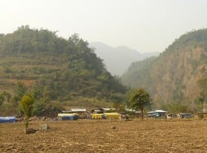 Pangtang lies at an altitude of 239 meters above sea level. The camp is located on the right bank of Mangdi chhu while trekking towards Shilingtoe thus, overlooking Pangtang settlements and the river itself. The trail starts with gentle descent and occasional short climbs. The entire trek will take about four hours and the last leg before reaching Shilingtoe ecocamp is a climb for over half an hour. The trail is very rich for bird watching with many birds such as thrushes, drongos, hornbills, partridges, pheasants, bulbuls, tree pies, barbets, eagles, fowls and many other species.
Day 3: Shilingtoe to Pangbang
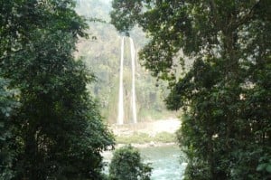
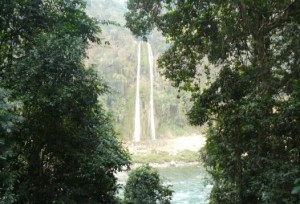
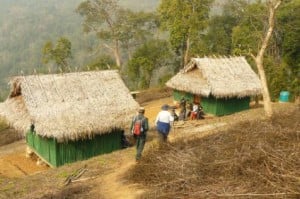 Shilingtoe is located at an altitude of 420 meters above sea level. The camp is on the way to a village and provides a good view of the area due to its location at a higher alleviation. Birds such as bulbuls, barbets, thrushes, hornbills, kingfisher, cormorant, wagtails, trogons and many other species can be seen along the trail between Shilingtoe to Pangbang, The hike from Shilingtoe to Changazam suspension bridge takes about 3 hours and on the way one can see religious cave, bat cave and a twin waterfall (Lelang). From Changazam, there is a motorable road to Panbang which connects to Indian Manas Tiger Reserve.
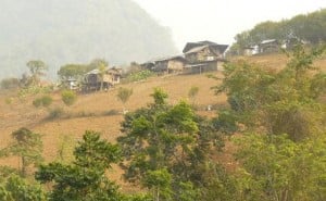 the Powgi lodue which is celebrated by Pangtang community is also celebrated by the Shilingtoe community. Tashibi village which is about an hour walk from Shilingtoe celebrates an annual tsechu on the 14th and 15th day of the 10th Bhutanese month.
After reaching Panbang, one could also exit via Indian Manas to Phuntsholing or Gelephu or Samdrupjongkhar.
Day 4: Pangbang to Norbugang
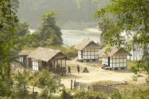 The camp site at Pangbang is located at a place called Anilademba at the junction of Mangdi Chhu and Dangme Chhu at an altitude of 160 meters above sea level. It is now connected with motorable road to Panbang which connects to Indian Manas Tiger Reserve.
The same road is also one of the entry and exit points into Royal Manas National Park from the Indian Manas. Panbang communities celebrate annual tsechu from 8th to 10th day of 11th Bhutanese month. Various mask dances are performed at the Sonam Choeling Dratsang.
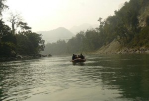
The other attractions at Panbang and Bhutan Manas include boating, river rafting, elephant rides and wildlife watching. The Park Range Office at Manas coordinates these services. While boating and river rafting along the Manas river, one can see goral, capped langurs, cormorants and many other bird species besides the beautiful landscape.
 Norbugang can be reached either from Bhutan Manas or from Nanglam under Pemagatsel Dzongkhag. The trek between Pangbang- Norbugang will take approximately six hours and is the longest trek of all. Most of the birds sighted along the Shilingtoe-Pangbang eco-trail are also found along Pangbang-Norbugang eco-trail. The eco-camp at Norbugang is located at a place
called Dorji Jadram. The road from Nanglam to Pangbang has reached till Tsheshengzor, with another two and half hours walk to the camp.
This road is also one of the entry and exit points to reach Royal Manas National Park. The five villages along the trail from Nanglam to Norbugang conduct Tsechus and among them the Tsechu at Nimshongborang village is unique and entertaining. It is held annually from 8 to 10th day of 5th Bhutanese month and from 9 to 10 day of 8th Bhutanese month.
After Norbugang, one could also exit via Nanglam and Samdrupjongkhar.


