
Merak and Sakteng (the Brokpa Villages)
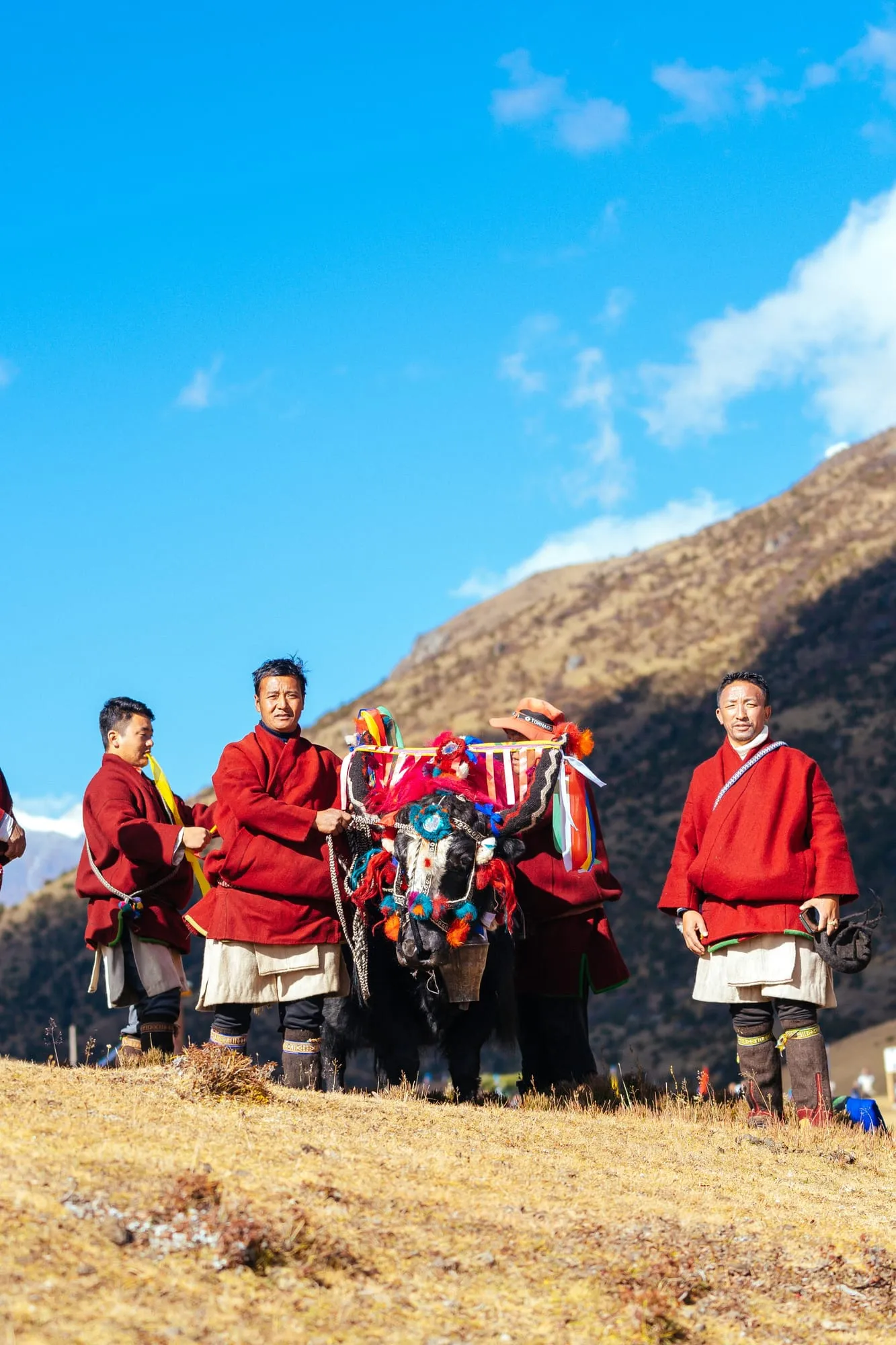
Merak and Sakteng are two highland villages in eastern Trashigang, home of the Brokpa — semi-nomadic yak herders with their own language and their own dress — set inside the Sakteng Wildlife Sanctuary. Merak sits at about 3,500 m. This is several days, not an excursion, and how we run it is worth asking before you plan the rest of your trip.
Who the Brokpa are
Brokpa means something like men of pastures, and it is a description rather than an ethnonym: these are yak and sheep herders, semi-nomadic, moving with the season between pasture and village.
They speak their own language — not the Tshangla that serves as the lingua franca everywhere else in the east — and you will recognise them before anyone tells you who they are. Yak hair and sheep wool, and the tsipee cham: a felted black hat with spider-leg spouts sticking out of it, which exist to run the rain off your face rather than down it. It is the most photographed hat in Bhutan and there is a reason for its shape.
By oral tradition the Brokpa came here after fleeing a tyrannical king named Drayba Jabu in Tibet, a story usually dated to 1347. That is how it is told; no document we could find carries it, and we would rather hand you the tradition than dress it as history.
What changed: there is a road now
For most of the time we have been writing about Merak and Sakteng, they were a five- or six-day trek, and much of the internet still describes them that way — including this page, until recently.
A road now reaches Merak. It has been ridden from Trashigang to Merak and back inside a day: 136 kilometres. Even trek itineraries now begin by driving to a trailhead at Chaling rather than walking out of Trashigang.
Three things stop that being good news on its own:
- The surface. The tarmac gives out and becomes gravel and mud.
- Nobody agrees how long it takes. Published times for the same leg run from an hour and a half to three hours, which tells you it depends on the day.
- It is not dependable. The national broadcaster has reported land instability at Phongmey forcing Phongmey and parts of Sakteng onto a longer route for more than a month.
So: ask us how we are running it this season before you build an itinerary around either answer. Sometimes it is a drive, sometimes it is a walk, and the honest version changes.
One new route should not be confused with those existing options. On 6 July 2026, Trashigang Dzongkhag announced that a team had completed an eight-day survey for a proposed corridor from Sakteng through Merak towards Samcholling. The Yeti Tracking Trail is still being planned — no visitor opening or operating itinerary has been announced.
The sanctuary
Both valleys sit inside the Sakteng Wildlife Sanctuary, created in April 2003 and running from about 1,500 m to 4,500 m. It is on Bhutan’s UNESCO World Heritage tentative list.
It is also the one protected area anywhere known for listing the migoi — the yeti — among the things it was made to protect. Believe what you like about the animal; the fact about the sanctuary is true, and it tells you something real about how these mountains are regarded by the people who live in them.
Before you go
It is high. Merak is around 3,500 m and Sakteng a little under 3,000 m. Come with warm layers and boots, and do not make this your first night at altitude.
And it is somebody’s home. The single thing we ask of guests here: ask before you photograph a person. The dress is extraordinary and the temptation is obvious, and a raised camera without a question asked is the difference between a visit and an intrusion. Your guide will ask for you if you would rather not.
How it fits your trip
Time it for Trashigang Tshechu in November or December and you get the reverse journey for free: the Brokpas come down to the dzong in full dress, and so do people from Merak and Sakteng to Gom Kora for its tshechu in the second Bhutanese month.
See things to do in Trashigang for how the rest of the district fits around it.
Tours that visit Trashigang


Frequently asked questions
Who are the Brokpa?
Semi-nomadic yak and sheep herders — "men of pastures" — living in the Merak and Sakteng gewogs of eastern Trashigang. They speak their own language, distinct from the Tshangla spoken across the rest of the east, and they dress unmistakably: yak hair and sheep wool, and the tsipee cham, a felted hat with spider-leg spouts that carry the rain off your face.
Can you drive to Merak and Sakteng now?
A road reaches Merak, and it has been ridden from Trashigang and back in a day. That does not make it a day trip we would sell you: the surface turns to gravel and mud, published drive times for the same stretch vary from an hour and a half to three hours, and the road is not dependable — the national broadcaster has reported land instability at Phongmey putting villages on a longer route for over a month. Ask us how we are running it this season.
How many days do you need for Merak and Sakteng?
Several. The two villages are hours apart, they are high — Merak is around 3,500 m — and whether you walk between them or drive changes the shape of the whole eastern leg of your trip. Treat it as a section of an itinerary, not a stop on one.
When did Merak and Sakteng open to tourists?
Around 2010 — some sources say 2009. Either way they were closed to visitors for the whole of Bhutan's first thirty-five years of tourism, which is why they feel the way they do.
What is the Sakteng Wildlife Sanctuary?
The protected area both valleys sit inside, created in April 2003, running from about 1,500 m to 4,500 m. It is on Bhutan's UNESCO World Heritage tentative list, and it is known for being the one protected area in the world whose stated reasons include the migoi — the yeti.
Tailor-made travel
Begin your journey to the Last Shangri-La
Every Little Bhutan itinerary is private and tailor-made. Tell us what draws you to Bhutan — festivals, treks, monasteries, food — and we will design the journey around it.